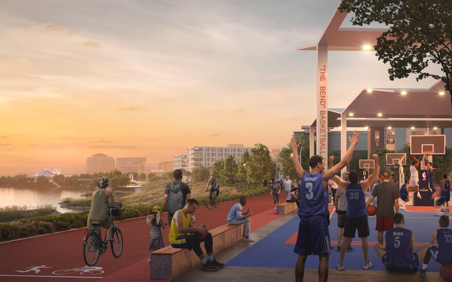
Imagine the busy thoroughfare of Riverside Drive changed to a tree-lined riverside park boulevard, with two lanes, bike paths and parking along the river.
Or picture Dress Plaza effectively gone — transformed into a multi-use space with elevated crescent walkway, biking opportunities and a rock wall.
These are a few of the myriad ideas revealed on Tuesday night at Old National Bank in downtown Evansville.
The Evansville Regional Economic Partnership (EREP) along with design firm Sasaki, unveiled the massive long-term plan to revamp 50 miles of the Ohio Riverfront from Mount Vernon to Newburgh. It's called the Ohio River Vision and Strategic Plan, and it's years in the making.
“This is a 620-page plan for the next 10, 20, 30 years of riverfront activation, riverfront vitality, from all the way from Mount Vernon to (Newburgh),” said Josh Armstrong, EREP chief economic development officer.
This plan includes feedback from nearly 10,000 points of contact —public comments and questionnaires from people of all ages about how they use the riverfront, and perhaps more importantly — how they’d prefer to use the riverfront.


The vision includes drastic changes to Evansville’s downtown.
Anna Cawrse is a principal, and landscape architect with Sasaki. Reimagining Riverside Drive as a slow-speed boulevard is one of the biggest parts of this plan.
“Something that is slowing you down, keeping you downtown to shop to really explore the city, but also to go out into the new park,” she said in a media preview.
She’s referring to Great Bend Park, which according to Sasaki, would be filled with new trails, dining destinations, sports courts, places for play, and hundreds of units of housing.
Of course, flood mitigation adds to the engineering challenge.
“So thinking about the flooding, thinking about sightlines, thinking about activation, that all informs how we design,” she said.
Sasaki’s job included all aspects of how the river interacts with the city — how the water level changes and how it works with the levee.
Armstrong said the entire project came about because the riverfront is underutilized.
“People can't connect to the river, you can't really touch the river. So let's start creating ways to get down there,” he said.
Plans include kayak rental, pathways right to the water and more ways to reach the river on foot. There are also boat launches and even ferry services imagined in the plan.
Overall paradigms include ideas that draw the river to its downtown, and vice-versa. The “Stitch the City,” idea is to reconnect downtowns to the rest of their cities, and “Hug the River.”
Armstrong said it’ll take at least two years of fundraising and schematic design before any construction.
“So the first thing you're going to see is some engagement begin, again led by Sasaki on schematic drawings for key areas along the plan,” he said. “So we know that schematic drawing is the first step in engineering.”
This will also aid in raising capital for projects.
Armstrong said downtown Evansville will be the first focus for these projects. Other cities will share what plans they'd like to work on achieving first.
"While DT Evansville is beginning schematic drawings this summer, efforts are underway in both Newburgh and Mount Vernon, related to housing, trails and funding efforts," Armstrong added via email.
Support independent journalism today. You rely on WNIN to stay informed, and we depend on you to make our work possible. Give to grow our local reporting today. Donate


